Saturday, July 13, 2013

No Pain, No Gain

I'm really not sure who came up with that saying, but today it was on my mind constantly as I did my longest and most challenging walk yet. It had a combination of paved and dirt trail with a modest elevation gain of 100ft over a little more than a mile and a quarter. It wasn't that I was in serious pain, but it was a noticeable component of my workout so I embraced it and walked on. Such a good feeling!

My neighborhood is on the edge of the Portland Metro Urban Growth Boundary so we have access to miles of paved and dirt trails right outside our front door. We even have a protected natural area with trails and obstacles in the middle of our development. It's perfect for strengthening my ankle. 


For the last two weeks I've been walking Gauge doggy each morning in my walking boot. I absolutely love our morning walks, so getting back to them has been good for my spirits. We have been doing a one mile neighborhood loop each morning, a paved out-n-back trail with a little hill each afternoon, and then sometimes a short neighborhood loop in the evening. 

After five and a half weeks in a walking boot, following the doctor's orders exactly, and resisting temptation to take off the boot when it was driving me nutty ... I graduated to an ankle brace this week.


My awesome GameDay low-profile, lace-up corset style brace comes with criss-cross strapping and velcro action to support the ankle in action.

Over the next two weeks I'll be working on range-of-motion and endurance so I can successfully return to 8hr shifts on July 29, and my regular 12hr shifts on August 12. 

I hope to start working in a few of these dirt trails with Gauge at my side. For now ... Charles has been going along so she can get in a few faster sections and critter hunting. 


Of course no broken bone story is really complete without updated x-rays. 


Two views of the healing bone, it's the one on the left. 


A side view of the break shows how it's still got a small gap, but it's healing! 

Thursday, July 4, 2013

Southern Oregon Coast Trail Exploration

My guy and I did a road-trip down the Oregon Coast this week, more specifically a camping/scouting trip along the Southern Oregon Coast. 

Since my mobility is limited, we decided on the first day of exploring I would check out the paved overlooks and walkways, art galleries, and coffee shops in and around Port Orford while my fella and Gauge doggy did a 15-mile section of the Oregon Coast Trail from Floras Lake to the Elk River just north of Port Orford. 

For those not familiar with the Oregon Coast Trail, be advised it is still a work in progress per my fella. He had to do a lot of research to figure out where the trail traversed beach, bluff, forest and/or road. Knowledge of the tide table is essential. 

Dropping the hikers off at Floras Lake


The Gold Bluffs area, south of Floras Lake, north of Blacklock Point


Looking down at the Gold Bluffs


Looking south toward Blacklock Point


Looking south toward Cape Blanco 


Typical trail view ... he followed the trail in the low center down to the beach and eventually across the Sixes River.


My viewpoint from the head of the Sixes River canyon, I did an early scout for the first river crossing.

Often, this is what the beach trail sections looked like.


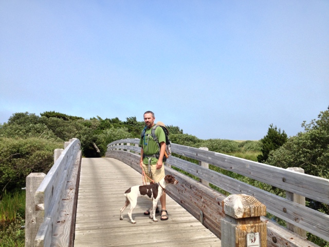
This section of the Oregon Coast Trail requires dogs be on leash at all times. It is also known for constant winds, see how Gauge's ears and leash are flying?


Having a shuttle driver is helpful on the Oregon Coast Trail as there are times you may wish to backtrack rather than cross a wide river section with a strong undercurrent and deep, hidden sections.  (We found it easy to communicate via text messages. Signal was reliable for Verizon and AT&T.)

This is the Elk River as the tide was just beginning to come in. That is Humbug Mountain in the distance.

On our second day we headed south to the Oregon/California border and then made our way north to check out Oregon State Park wayside, viewpoint, trailhead, campground south of Port Orford. If it had an OSPR sign, we checked it out. These are a few pictures from those stops.

Harris Beach State Park looking south from the lower parking area.


Whaleshead Rock Beach Access Area


Looking south from the Arch Rock paved trail. Spruce Island and Secret Beach on the left. You can hike down to Secret Beach via the Oregon Coast Trail. 


Arch Rock


Natural Bridge Viewpoint also accessible via the Oregon Coast Trail


Windsurfer area north of Pistol River is the first stop on the World Windsurfer Tour. There were several windsurfers cruising along at probably 30mph or more.


What's a trip to the beach without a sunset? 


On our third (and last) day I stayed in camp while my fella and Gauge doggy did the Humbug Mountain loop trail before we headed home to Portland. Sadly my fella reports the viewpoints mentioned in the hiking books and trail brochures are minimal.

Here is the one good view he found.


If you go and plan to hike the Oregon Coast Trail, Blacklock Point and Gold Bluffs areas staying at Cape Blanco State Park is the most convenient. We stayed at Humbug Mountain State Park which is smaller, nicer and more tent friendly than Cape Blanco. IF you want to do some hiking near Indian Sands, Arch Rock, Natural Bridge then staying at Harris Beach State Park is probably most convenient.

If you are into a full day of exploring and hiking (and driving), it is worthwhile to start early and drive south to the California border and head North with stops at all the Oregon State Park viewpoints, overlooks, etc. There were several hike options that take you down to the beach, along forested sections and even a waterfall.


Thursday, June 6, 2013

Angels Sometimes Fall

I've been busy reading blogs, watching the herd's progress (most of the hikers I'm following are approaching/leaving Kennedy Meadows), and planning for my first trip only to have to push it all out to early August. 

I'm on the sidelines for at least six weeks, probably thru all of July due to a trail injury last week. After an absolutely awesome ten mile, 2700' gain hike in the Gorge, the trail gave way below my left foot, sending me off the side of the trail, and breaking my right fibula. 

I actually heard the snap as I was falling. As a nurse, my brain went into assess and plan mode. With three other hikers in my group, it made the situation less frightening. My fella pulled me back up to the trail and then headed off with Gauge doggy to fetch the truck to the trailhead, I immediately elevated my leg on my backpack and took something for the pain and inflammation, and then I assessed if I could move my ankle. It moved stiffly and painfully, so I kept my boot on (fully laced to compress my ankle), figured out just how far it was to the trailhead (50yds!), and figured out if I could make it that far. My other two hiking partners helped me stand, gave me a hiking pole, and then took my advice to stand back.


The folks at Multnomah Falls Snack Shack gave my fella ice, I kept my foot elevated and iced in the back seat, and we went directly to Urgent Care. And ... the x-rays showed an oblique nondisplaced fracture of the distal fibula. They set me up with a temporary brace, we picked up some crutches at the pharmacy and I sat around all weekend with my foot elevated until I could see a specialist after the weekend! 


I saw the specialist on Monday, repeat x-rays indicated the fracture was bad (actually three breaks) but it remained nondisplaced so I escaped surgery and will be in a walking boot for six weeks.

I'm hoping to go back to work in six weeks or shortly thereafter, but I'm not sure how long it will be before I'll be doing my long out-n-back 12-14 mile Trail Angel day trips. 

My hope is to be able to do a lot of shorter out-n-back hikes and/or short midweek overnight trips by early August as the herd approaches mid-Oregon. 

Until then I am doing everything I am told to do, not pushing it to much, reading blogs and books. For those who know me ... I don't sit still really well. This will be a long six weeks. 


Thursday, May 2, 2013

Just Wasn't Feelin' It

What should have been an awesome day on a section of the PCT just across the river from Cascade Locks . . . felt more like a task to complete than a nice hike along the PCT. I just couldn't get in the mood. At one point I almost asked my hiking partner if we could just blow it all off after a mile and go to lunch.

The ONLY thing making me put one foot in front of the other was pondering the question . . . what really makes a thru-hiker keep going? OK, and I was thinking about what a whiner I was being.

I really didn't have anything to whine about.

We started out on a high note when we ran into the famous PCT Trail Angel Shrek (since 1992!) who was on duty in the toll booth as we crossed the Bridge of the Gods.

We had wonderful weather, partly cloudy skies with a slight breeze, mostly dry trail, and only two other cars in a huge parking lot. AND, I got the latest version of HalfMile's PCT app to work.

Total PCT Miles = 4

At this rate it just might take me 15 years to complete the Oregon and Washington sections of the PCT . . .


Wednesday, April 24, 2013

Trail Angel Training Hikes

With all the PCT blog postings ... we just couldn't miss an opportunity to hike a section near our home in Portland today. We saw this as an opportunity to train ourselves to carry heavier loads as well as test some gear.

Before we headed out I updated HalfMile's iPhone App, loaded up my pack with simulated apple weight (this is the training part), grabbed a pair of new Darn Tough socks I've been wanting to test, and hit the PCT SoBo from Cascade Locks with some friends from the Cascadia Women's Mountain Group.

Everything worked out well, except the electronics. Just like last year, I have to go through the basics again. Last year I remembered using the app to locate potential campsite and water caches, this year I can't seem to see that. I need to do more research, but I think I must be doing something wrong. No worries today, I was on a section of the trail I know well.

Many of the PCT hikers take the Eagle Creek Alternate from Whatum Lake, experiencing one of the most beautiful trails in the Columbia River Gorge. Unfortunately they miss this beautiful section of trail with its views of the river, waterfalls and pinnacles.

Tomorrow, we hike from Cascade Locks to the Greenleaf overlook with heavier packs ... apples weigh a lot ya know!


Monday, April 15, 2013

My Trail Angel Style

Last year (2012) was my first year as a PCT Trail Angel. I had an opportunity to try out a number of approaches to supporting thru-hikers. Toward the end of the season, I stumbled upon the best approach for me . . . I carry a backpack full of apples, atomic fireballs, and small snacks to offer to unsuspecting thru-hikers I encounter while day-hiking sections of the PCT.

Why apples? They pack easily, it takes a lot to hurt 'em, they don't leave juice in my backpack, and the hikers don't have to feel like they need to stop and visit for a long period of time. Just grab 'n go!

Why Atomic Fireballs? Why Not! They are an awesome cinnamon jawbreaker treat that really puts some pep in your step.

With an off-road capable vehicle, I can access more remote sections of the PCT, usually far from a resupply stop. Last year I could be found just about anywhere between Barlow Pass (2100) in Oregon and Hart's Pass (2630) in Washington, usually when a group of 15-20 hikers were passing through. Thus my trail name . . . Where's Chris?

I typically park at a trailhead, load the backpack and head south toward the thru-hikers to hand out goodies. At 6-7 miles in, I rest and eat lunch, and then head north back to the trailhead . . . handing out more goodies. If time permits, I'll hang out a bit at the trailhead handing out the last of my apples before heading home.

I'm fortunate to have a job that allows me to hike 3-4 days a week, usually midweek. I try to work in at least one day on the PCT. This season I'll also be incorporating some camping alongside the PCT with my day hikes. When I'm camping . . . I'll be bringing along extra drip coffee to share with hikers each morning. There's nothing like good strong coffee in the morning. If you smell it ahead on the trail . . . please stop and I'll make you a cup.

Thanks to the blogs of so many PCT hikers, and comments on the PCTA website, I can get a good idea of where the herd is along the trail. There are already several really good blogs from hikers who are on the trail and/or hitting the trail in the next few weeks. A shout out to HalfMile for creating HikePress that provides a daily aggregation of blog posts; he has made it so much easier to find blogs to follow this year.

The PCTA said they've issued more than 1000 permits for this season . . . so I better start training to carry a lot of apples each day! And, I'll be enlisting the help of my fella Charles to join me as often as he can.

Tuesday, April 2, 2013

2013 Hikers Are On Trail!

Spring has made a first real appearance here in Portland. The Columbia Gorge is waking up and starting to display bursts of wildflowers at the eastern end.

While the PCT remains covered in snow throughout most of Oregon, the first of the PCT hikers are slowly making their way onto the trail at the Mexican border ... time to stow the snowshoes, do my gear checks and hit the trails again myself.

As I write this, there are already several hiker blogs I'm following in anticipation of intersecting with these hardy hikers when they begin reaching Oregon in late July.

If you are interested in finding a few blogs to follow, check out this great compilation site http://www.hikepress.com/

More later with my own PCT Trail Angel gear review ...