My guy and I did a road-trip down the Oregon Coast this week, more specifically a camping/scouting trip along the Southern Oregon Coast.
Since my mobility is limited, we decided on the first day of exploring I would check out the paved overlooks and walkways, art galleries, and coffee shops in and around Port Orford while my fella and Gauge doggy did a 15-mile section of the Oregon Coast Trail from Floras Lake to the Elk River just north of Port Orford.
For those not familiar with the Oregon Coast Trail, be advised it is still a work in progress per my fella. He had to do a lot of research to figure out where the trail traversed beach, bluff, forest and/or road. Knowledge of the tide table is essential.
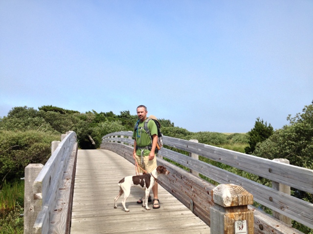
Dropping the hikers off at Floras Lake
The Gold Bluffs area, south of Floras Lake, north of Blacklock Point

Looking down at the Gold Bluffs

Looking south toward Blacklock Point

Looking south toward Cape Blanco

Typical trail view ... he followed the trail in the low center down to the beach and eventually across the Sixes River.

My viewpoint from the head of the Sixes River canyon, I did an early scout for the first river crossing.

Often, this is what the beach trail sections looked like.

This section of the Oregon Coast Trail requires dogs be on leash at all times. It is also known for constant winds, see how Gauge's ears and leash are flying?

Having a shuttle driver is helpful on the Oregon Coast Trail as there are times you may wish to backtrack rather than cross a wide river section with a strong undercurrent and deep, hidden sections. (We found it easy to communicate via text messages. Signal was reliable for Verizon and AT&T.)
This is the Elk River as the tide was just beginning to come in. That is Humbug Mountain in the distance.

On our second day we headed south to the Oregon/California border and then made our way north to check out Oregon State Park wayside, viewpoint, trailhead, campground south of Port Orford. If it had an OSPR sign, we checked it out. These are a few pictures from those stops.
Harris Beach State Park looking south from the lower parking area.

Whaleshead Rock Beach Access Area

Looking south from the Arch Rock paved trail. Spruce Island and Secret Beach on the left. You can hike down to Secret Beach via the Oregon Coast Trail.

Arch Rock

Natural Bridge Viewpoint also accessible via the Oregon Coast Trail

Windsurfer area north of Pistol River is the first stop on the World Windsurfer Tour. There were several windsurfers cruising along at probably 30mph or more.

What's a trip to the beach without a sunset?

On our third (and last) day I stayed in camp while my fella and Gauge doggy did the Humbug Mountain loop trail before we headed home to Portland. Sadly my fella reports the viewpoints mentioned in the hiking books and trail brochures are minimal.
Here is the one good view he found.

If you go and plan to hike the Oregon Coast Trail, Blacklock Point and Gold Bluffs areas staying at Cape Blanco State Park is the most convenient. We stayed at Humbug Mountain State Park which is smaller, nicer and more tent friendly than Cape Blanco. IF you want to do some hiking near Indian Sands, Arch Rock, Natural Bridge then staying at Harris Beach State Park is probably most convenient.
If you are into a full day of exploring and hiking (and driving), it is worthwhile to start early and drive south to the California border and head North with stops at all the Oregon State Park viewpoints, overlooks, etc. There were several hike options that take you down to the beach, along forested sections and even a waterfall.
No comments:
Post a Comment