Friday, July 26, 2013

One Step at a Time

Eight weeks ago today a section of trail gave way and I broke my fibula. Seven weeks ago Anish started her attempt to break the fasted unassisted PCT thru hike. We both share a love for the PCT, and we are both taking it one step at a time. I've been following her story since the beginning, and she is truly inspiring. 

For the past few weeks I have been working hard at getting back the strength I lost due to the injury.  My goal ... to be able to step back on the PCT and hike as a trail angel before the herd approaches. As Anish approached, I realized I might be ready to provide her with magic as she approached Ollalie Lake. 

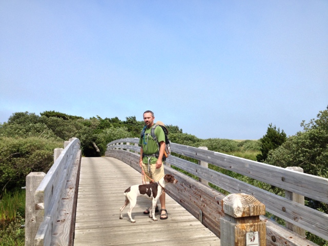
As the day approached, a plan was developed. SlimeDog (my fella) would drive so I could save my energy for the trail, we would split the magic supply between us, SlimeDog would head out ahead of me on the trail with Gauge doggy, and I would head out a short time after that for a shorter hike. We would meet back at the Ollalie Lake Resort. 

When we got to the lake, I stopped in at the store to see if they had seen Anish yet. Nope. They were hoping she would come through, but they couldn't be sure she would. Anish averaged 43 miles a day through California, and we knew she was doing 50+ miles a day in Oregon. 

Not knowing if we had missed her, we got into action with our packs and headed out. SlimeDog and Gauge were long gone in a few minutes. 

For me the process was slower. I was suddenly emotional. This would be my first time back on a real trail since the accident, this would be my first trail with rocks and off-camber foot placements, and it would be my first time shouldering a fully-loaded trail angel pack.

As I headed out, I repeated over and over again to myself to take it one step at a time. While the trail tread was challenging, I soon relaxed as I became certain I could handle it. 


The trail was fatiguing, but the views as the trail climbed were rewarding. 

     Mt Jefferson just beyond Ollalie Butte 

At about the 45-minute / 1.65 mile mark I chose to go ahead and turn back. My longest hike so far had been 3.5 miles on pavement and/or gentle trail with no real elevation gain. With my return to work just a few days away, overdoing it was not an option. 

When I returned to the trailhead I relaxed and ate a snack, convinced Anish, SlimeDog and Gauge would be just behind me. After 30-minutes at the trailhead I hiked over to the store. The store crew is very friendly and encouraged me to just relax on the porch and enjoy the view. 

    What a great view from the porch

I wasn't there long before I was joined by IronMan and French Toast, two of the first thru-hikers of this year. Time flies when you are chatting with thru-hikers, and it wasn't too much longer before SlimeDog and Gauge showed up.

     French Toast, IronMan, Trapper Keeper (Ollalie PCT Angel)

While we were all chatting away on the front porch, Anish just seemed to appear. She has the gift of being super efficient while being personable and social. During her 25 minute stop she refilled her water, grabbed a quick charge for her phone, drank a strawberry lemonade powerade, ate some grapes, an apple, and some other misc snacks, did a quick resupply from the store and our magic bag, and headed back on the trail at what seemed like an amazing pace. I smiled as I watched her leave, she too just seems to be taking it one step at a time. 


Good luck to you Anish on the rest of your hike, I've sent an update forward to another trail angel in Washington. She knows you will be in Washington by this weekend. 

      Anish still looks strong!!


Sunday, July 21, 2013

Anish Approaches

For all you potential or actual PCT trail angel types ... 31yr old Anish (Heather Anderson) is attempting to set the 2013 Pacific Crest Trail Fastest Known Time by a female thru-hiker. 

Anish in the Sierras (source: FaceBook)

She started the trail on June 10th, knocked out the 1700 miles thru California in 40 days, and entered Oregon late in the evening of July 18. 

She is doing this attempt as an 'unassisted' or 'self-supported' hiker, which means she will NOT have anyone following, or otherwise meeting her in a prearranged manner to give her support.

She usually puts in more than 40 miles per day, sometimes she'll pull a 50 mile day. When in the high-Sierras, she did Forester Pass 13,200ft, Glen Pass 11,947ft, Pinchot Pass 13,200ft, Mather Pass 12,096ft and Muir Pass 11,973 ft in a two day, 79-mile trek! 

In Oregon the terrain often allows the thru-hikers to put in more miles per day, so she could easily average 45-49 miles per day ... or even more. 

A friend of mine has family in town for a few weeks and they wanted to do some trail magic, so I did some calculations for when Anish could be hiking through the Ollalie Lake area: 

The Oregon border is at mile 1698; the Ollalie Lake trailhead is at mile 2053. It's only 358 miles. 

 • If 40 mpd, Ollalie TH in 9days (Fri 26July)
 • If 45 mpd, Ollalie TH in 8days (Thurs 25July)
 • If 48 mpd, Ollalie TH in 7days (early/mid-day Weds 24July)
 • If 52 mpd, Ollalie TH in 6days (late Tues 23July)


Trail Magic is acceptable as long as it is NOT planned and coordinated. Several hikers on the PCT list serve have reported she could benefit from some high-calorie items such as candy bars, cookies, GU packets, cold non-diet sodas, cold gatorade, etc. She appears to be semi-vegetarian based on posts I've read so I would avoid meat products. She is eating cheese products. 

She keeps a very limited FaceBook blog that is accessible without having an account.  https://m.facebook.com/AnishHikes?refid=17

In my humble opinion she is one serious bad-ass woman! 

Oh yeah, the current speed record holders are Scott Williamson AKA 'Bink' and Adam Bradley AKA 'Krudmeister' who co-hold the current record of 65d, 9h, 58m which was set in 2009.

There are a few other fast hikers approaching our area, the herd appears to be spread between Sierra City (mile 1197) and Burney Falls State Park (mile 1423) with the tail-end of the hikers still making their way north of Yosemite (mile 960).

Saturday, July 20, 2013

Central Oregon Coast 'n Dunes

My fella and I did another road-trip along the Oregon Coast, more specifically a camping/scouting trip along the Central Oregon Coast between Waldport and Bandon. 

Trails and beach access in this section of the Oregon coastline are within the endangered Western Snowy Plover nesting area. There are several areas closed to dogs from March 15 - September 15. However, there were still plenty of trails and beaches open to Gauge doggy. 

Since my mobility was limited I spent most of my time on short paved and/or smooth trails, with a few short sessions walking in the sand each day. 

My fella did a few dog beach play times with Gauge doggy and a short out-n-back section of the Oregon Coast Trail between Sunset Bay State Park and Cape Arago while I wandered the Shore Acres State Park formal gardens and viewpoint trails.

Here are a few pictures we took on our trip. 

Oregon Dunes Day Use Area Overlook

Heceta Head Lighthouse

Umpqua River Lighthouse

Gauge 'n my fella found some interesting coastline.

The rock formations along this section of shoreline below Shore Acres State Park are part of the Coaledo Formation created from the collision of the Juan de Fuca and North American tectonic plates more than 45 million years ago. 

The 40-45 degree angles make for some dramatic wave breaking shows, especially during the winter. 

There was no shortage of beautiful cove beaches.

And, no shortage of good seafood. Our favorite place was Miller's on the Cove in Charleston, just south of Reedsport. These tasty baja crab tacos and a beer were $10 before tip! 

Suislaw National Forest has an amazing website with free downloadable topo maps for what appears to be ALL the trails and trailheads within it's boundary. 

If you go during Western Snowy Plover nesting season with a dog, you may find these links helpful. 

Here is the page that lists which trails are restricted during nesting season: 
http://www.fs.usda.gov/detail/siuslaw/learning/safety-ethics/?cid=stelprdb5411699

Oregon State Parks has a nice brochure of dog-friendly beaches:
http://www.oregon.gov/oprd/NATRES/docs/plover/DogFriendlyBeaches_web2013.pdf

Saturday, July 13, 2013

No Pain, No Gain

I'm really not sure who came up with that saying, but today it was on my mind constantly as I did my longest and most challenging walk yet. It had a combination of paved and dirt trail with a modest elevation gain of 100ft over a little more than a mile and a quarter. It wasn't that I was in serious pain, but it was a noticeable component of my workout so I embraced it and walked on. Such a good feeling!

My neighborhood is on the edge of the Portland Metro Urban Growth Boundary so we have access to miles of paved and dirt trails right outside our front door. We even have a protected natural area with trails and obstacles in the middle of our development. It's perfect for strengthening my ankle. 


For the last two weeks I've been walking Gauge doggy each morning in my walking boot. I absolutely love our morning walks, so getting back to them has been good for my spirits. We have been doing a one mile neighborhood loop each morning, a paved out-n-back trail with a little hill each afternoon, and then sometimes a short neighborhood loop in the evening. 

After five and a half weeks in a walking boot, following the doctor's orders exactly, and resisting temptation to take off the boot when it was driving me nutty ... I graduated to an ankle brace this week.


My awesome GameDay low-profile, lace-up corset style brace comes with criss-cross strapping and velcro action to support the ankle in action.

Over the next two weeks I'll be working on range-of-motion and endurance so I can successfully return to 8hr shifts on July 29, and my regular 12hr shifts on August 12. 

I hope to start working in a few of these dirt trails with Gauge at my side. For now ... Charles has been going along so she can get in a few faster sections and critter hunting. 


Of course no broken bone story is really complete without updated x-rays. 


Two views of the healing bone, it's the one on the left. 


A side view of the break shows how it's still got a small gap, but it's healing! 

Thursday, July 4, 2013

Southern Oregon Coast Trail Exploration

My guy and I did a road-trip down the Oregon Coast this week, more specifically a camping/scouting trip along the Southern Oregon Coast. 

Since my mobility is limited, we decided on the first day of exploring I would check out the paved overlooks and walkways, art galleries, and coffee shops in and around Port Orford while my fella and Gauge doggy did a 15-mile section of the Oregon Coast Trail from Floras Lake to the Elk River just north of Port Orford. 

For those not familiar with the Oregon Coast Trail, be advised it is still a work in progress per my fella. He had to do a lot of research to figure out where the trail traversed beach, bluff, forest and/or road. Knowledge of the tide table is essential. 

Dropping the hikers off at Floras Lake


The Gold Bluffs area, south of Floras Lake, north of Blacklock Point


Looking down at the Gold Bluffs


Looking south toward Blacklock Point


Looking south toward Cape Blanco 


Typical trail view ... he followed the trail in the low center down to the beach and eventually across the Sixes River.


My viewpoint from the head of the Sixes River canyon, I did an early scout for the first river crossing.

Often, this is what the beach trail sections looked like.


This section of the Oregon Coast Trail requires dogs be on leash at all times. It is also known for constant winds, see how Gauge's ears and leash are flying?


Having a shuttle driver is helpful on the Oregon Coast Trail as there are times you may wish to backtrack rather than cross a wide river section with a strong undercurrent and deep, hidden sections.  (We found it easy to communicate via text messages. Signal was reliable for Verizon and AT&T.)

This is the Elk River as the tide was just beginning to come in. That is Humbug Mountain in the distance.

On our second day we headed south to the Oregon/California border and then made our way north to check out Oregon State Park wayside, viewpoint, trailhead, campground south of Port Orford. If it had an OSPR sign, we checked it out. These are a few pictures from those stops.

Harris Beach State Park looking south from the lower parking area.


Whaleshead Rock Beach Access Area


Looking south from the Arch Rock paved trail. Spruce Island and Secret Beach on the left. You can hike down to Secret Beach via the Oregon Coast Trail. 


Arch Rock


Natural Bridge Viewpoint also accessible via the Oregon Coast Trail


Windsurfer area north of Pistol River is the first stop on the World Windsurfer Tour. There were several windsurfers cruising along at probably 30mph or more.


What's a trip to the beach without a sunset? 


On our third (and last) day I stayed in camp while my fella and Gauge doggy did the Humbug Mountain loop trail before we headed home to Portland. Sadly my fella reports the viewpoints mentioned in the hiking books and trail brochures are minimal.

Here is the one good view he found.


If you go and plan to hike the Oregon Coast Trail, Blacklock Point and Gold Bluffs areas staying at Cape Blanco State Park is the most convenient. We stayed at Humbug Mountain State Park which is smaller, nicer and more tent friendly than Cape Blanco. IF you want to do some hiking near Indian Sands, Arch Rock, Natural Bridge then staying at Harris Beach State Park is probably most convenient.

If you are into a full day of exploring and hiking (and driving), it is worthwhile to start early and drive south to the California border and head North with stops at all the Oregon State Park viewpoints, overlooks, etc. There were several hike options that take you down to the beach, along forested sections and even a waterfall.